


Space Weather vs. Natural Hazards: Swarm Satellites Pinpoint the Source of Global Disruptions
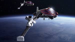
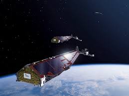
As revealed at the EGU General Assembly (EGU26) and reported by Phys.org on May 6, 2026, scientists have unveiled a powerful new project called Swarm-AWARE (Swarm Investigation of Space Weather and Natural Hazards Effects). The initiative, launched by the European Space Agency (ESA), utilizes the Swarm satellite constellation to solve a critical problem: distinguishing between electromagnetic signals caused by solar storms and those triggered by disasters on Earth.
While both space weather and natural hazards can disrupt the modern world, knowing where the signal originates is the key to preventing “false alarms” and protecting infrastructure.
The Signal Overlap Problem
The magnetosphere-ionosphere system is constantly bombarded by solar wind. When solar activity increases, it creates fluctuations in Earth’s electric and magnetic fields.
-
The Conflict: These “space weather” signals can look almost identical to the faint electromagnetic signatures generated by massive natural hazards on the ground, such as earthquakes, volcanic eruptions, and tsunamis.
-
The Risk: Without the ability to tell them apart, power grid operators, satellite controllers, and early-warning systems might misinterpret a solar storm as a terrestrial disaster, or vice versa.
Case Study: The 2022 Hunga Tonga Eruption
The project uses the massive Hunga Tonga-Hunga Ha’apai eruption as a benchmark for its accuracy.
-
Atmospheric Perturbation: The eruption sent pressure waves all the way to the upper atmosphere, causing significant changes in ionospheric density.
-
Instantaneous Effects: These waves triggered electric fields that traveled along Earth’s magnetic field lines, causing measurable disturbances on the exact opposite side of the Pacific Ocean.
-
Detection: Swarm magnetometers captured these disturbances, providing a “fingerprint” of a ground-based event that reached space.
How Swarm-AWARE Works
The project, led by Georgios Balasis of the National Observatory of Athens, integrates multiple datasets to create a “filtered” view of Earth’s surroundings:
-
Swarm Satellites: Providing precision measurements of magnetic fields, plasma density, and temperature.
-
Copernicus Sentinel-5P: Adding atmospheric chemistry data to the mix.
-
Machine Learning: Advanced time-series analysis and AI are used to sift through billions of data points to classify signals as either “Solar-Driven” or “Hazard-Driven.”
Impact: Smarter Forecasting and Resilient Grids
The ultimate goal of Swarm-AWARE is to transition from research into a near-real-time decision-support tool.
-
Infrastructure Protection: By identifying a solar storm early, power grid managers can take preventative measures to avoid the type of geomagnetic events that knocked out 38 SpaceX Starlink satellites in 2022.
-
Disaster Response: Pinpointing electromagnetic signatures from earthquakes could lead to more refined early-warning systems for coastal and seismic-prone regions.